Recreation

As the summer months approach, many naturally retreat to their backyard pools to cool down. The existence of swimming pools in one’s own backyard was rare until the 1950s. In 1952, there were only 17,000 swimming pools in the United States according to the National Swimming Pool Institute. By 1958, that number had grown to over 133,000.

Pool advertisers beckoned new installations by calling swimming pools the new status symbol instead of a shiny new automobile. Installing a new pool was quite an investment in the 1950s at approximately $4,000, however most paid in monthly installments. One argument for buying a pool: “in time it will pay for itself through savings on all-family vacations. The family stays home now to swim.”

Early pool enthusiasts of the 1940s often resorted to building their pool out of a variety of materials including roofing paper and large vats. However, the 1950s brought the introduction of low-cost prefabricated pools.

Two popular options in the 1950s were the Buster Crabbe Swimming Pool and the Esther Williams Swimming Pool. Both were well-known swimmers and film stars that launched a line of pools that were heavily advertised:

“Yes, you can have this big, luxurious, in-the-ground pool, designed by Esther Williams, Internationally famous swimming star-the newest and smartest means of family fun and healthful, out-door exercise. It means less hot, summer driving on crowded highways to club or beach”.

“Installing your Buster Crabbe pool yourself is easier than ever, thanks to ‘Unitization.’ Buster Crabbe provides all the material…everything except the hole. Just two or three week-ends of work, and you’re the proud owner of a bigger, better, safer, and stronger pool.”

For those of us who could only dream of a swimming pool in the backyard, Sur Joy was there for only a dime to relieve us from summer heat.

Read more

A Virginia legend states that when Native Americans destroyed several settlements on the New River, south of what became known as Hungry Mother Park, Molly Marley and her small child were among the survivors taken to the raiders' base north of the park. Upon finding help, the only words the child could utter were “Hungry Mother,” indicating a strong craving for food.

A significant highlight of the late 1940's was for my family to embark on a short excursion to a local state park, Hungry Mother State Park, located in Smyth County is just above the Virginia line near Marion, Virginia.

The park, which gets its name from the Hungry Mother Creek that feeds the lake, is situated on a 108-acre lake with a manmade beach. What makes it so pretty is the gorgeous view of the mountains surrounding the lake.

Hungry Mother Park with the little white fence visible in the lower left

The beach consisted of a fully enclosed white wooden fence positioned in the water along the left side of the beach. Parents could allow their youngsters to play in this fenced-in area without having to worry about them getting too far out in the water.

On one journey, I played in the sand with my bucket and shovel most of the day. When we departed and returned to our W. Watauga apartment, I realized that I did not have my bucket. Mom picked up the phone and pretended to call the park and ask them to be on the lookout for my sand bucket. This gave me hope that I would eventually get it back. Isn't that just like a mom? I soon forgot about my sand bucket.

We went to this recreational area several times during summer months. I have pictures of these trips in our family album. For some reason, we stopped going there around 1952.

During the July 4th, 1993 weekend, my family and I revisited Hungry Mother Park. It looked about the same except the wooden fence in the kiddy's pool was long gone. The picnic area was a little bigger than I remembered it. Several new parking lots had been added. It was about as crowded in 1993 as I remembered it to be in 1948.

I never gave any thought to how Hungry Mother Park got its unique name. During this visit, we pulled over at a Virginia welcoming station and I asked the attendant if she know how the park got its name. Surprisingly, she did not. I just had to find out. The lady, wanting to assist this, searched through some material she had but could find no reference to it. 

During March of 1996, my son, Brandon, and I went to our main public library. He was doing a research project on Edgar Allen Poe. While I was in one of the isles looking at some books, he came walking up to me grinning. He had found the park mentioned in a book.

And now, (drum roll)… According to my source, here is the legend of Hungry Mother Park: “An early pioneer named Molly Marley, her husband, and their small son were caught in an Indian raid;  her husband was killed immediately.

“Molly and her son fled from the Indians. After several days of wandering and eating berries to stay alive, Molly collapsed from hunger near a creek at the foot of a mountain. Her son, after trying to arouse his mother, followed the creek seeking help until he arrived at some houses. He was so weary and hungry himself that the only two words he uttered were “hungry” and “mother.” Help came too late for his mother.” The mountain was named Molly's Knob and the creek became identified as Hungry Mother Creek. The park later assumed that designation.

Advertisement for Lakeview Park, formerly Cox's Lake and later Cox's Lake

I have fond memories of going to that beautiful park on Saturdays in the late 1940s and early 1950s. I have no explanation why we stopped going there. I soon became much enamored with another body of water … Cox's Lake (originally known as Lake Wataussee), once located on Lakeview Drive (figure 2). I could quickly access it on my bicycle.

Once, I nearly got electrocuted when I stepped on a live wire that had fallen to the ground; I was in a wet bathing suit and caused quite a stir, but that is another story. And no, I didn't have my sand bucket and shovel at this lake.

Read more

Prior to the summer of 1944, public recreation in Johnson City consisted of a baseball park on Legion Street, the Surjoi Swimming Pool (later renamed Carver Park near the intersection of W. Watauga and W. Market streets) and Memorial Football Stadium, constructed by the federal Works Progress Administration (WPA) in the 1930s.

In April 1944, the city charter was amended, establishing the first Park and Recreation Department. A nine member Board of Directors was appointed with Kiwanian C. Howard McCorkle serving as the first chairman and Kiwanian Howard A. Johnson as the first Park and Recreation Director.

Later that same year, Kiwanis became the first city group in Johnson City to sponsor a public park, known as Kiwanis Memorial Park, acquiring a sizable block of city property between Main and Market streets, on which they built two baseball diamonds, one on each end, and a nice picnic pavilion.

Kiwanis Park on W. Market Street. Henry Johnson School Can Be Seen in the Background

Not to be outdone, the rival Optimists offered sponsorship of a city playground on Poplar Street, a few months later, beginning a friendly competition among the city's civic groups, Lowe said.

In 1945, the Jaycees joined in the fun, sponsoring a neighborhood park adjacent to Stratton Elementary School. And in 1948, the Rotarians brought a new angle to the city's park system by developing a naturalistic picnic park on Broadway.

This helpful tradition continued through the next two decades, with the Lions Club adopting its park off Unaka Avenue in the late 1950s and the Civitan Club taking over what had previously served as the city dump in 1963.

In more recent years, the Metro Kiwanians developed a comprehensive park on Knob Creek Road. Later, the North Johnson City business club, forgetting all regional prejudice, took over sponsorship of the former Powell Square in Southwest Johnson City.

In the 43 years since the Kiwanians built their first baseball diamond on Market Street, their accumulated investment of time, labor and funds went to the creation of a $250,000 facility, which, according to Lowe, continued to be the most utilized park in the city.

In early 1950, my family moved to Johnson Avenue, directly behind Henry Johnson Elementary School playground. I vividly recall the three (I think) carousels inside the white picket fence. To power it, some of the older children ran on the inside of it while holding on to the rail until it reached a desirable speed. We then jumped aboard.

According to today's safety standards, some of these rides were a bit unsafe. Failure to get back on it could cause you to trip and fall on the ground. I don't see these rides anymore. The most common displeasure was motion sickness. We quickly learned when to stop riding it.

Another favorite was the metal sliding board midway in the park. Initially, sliding down it was difficult because it was a bit rusty. We corrected that deficiency by bringing sheets of wax paper from home and rubbing them on the slide for several minutes. It amazed us how slippery it became with only a few slides. The journey down it then meant a lightning fast departure into the dirt.   

Another memorable pastime was watching baseball games; Little League teams played on the east end of the park, and Connie Mack batted at the west side. Other games involved numerous adult leagues.

One significant memory of the park was the small snack shack facing Market Street and Henry Johnson School. My most frequent purchase was a frozen Zero candy bar that cost a nickel. Behind it to the south was the large elevated pavilion that was used for a variety of programs, including showing movies.

Even today, I occasionally drive to Kiwanis Park, park my vehicle and take a stroll back to my own private “yesteryear,” enjoying the memories that made our youthful lives so pleasurable. Where did the time go? 

Read more

A July 1889 Comet newspaper article asked the question, “Where are you going to spend the month of August?”

hot city for a few days or weeks of recreation and relaxation and go where you can stay cool, drink from chalybeate water (impregnated with or containing salts of iron). It is water as good as can be found anywhere.

“And then there's fishing, hunting, boating and getting all-you-can-eat. You need to pack your essentials, travel to Unicoi County, stop at Unaka Springs at the Unaka Springs Hotel and converse with the friendly landlord, Mr. A.V. Deaderick.

“The owners of the establishment don't exhibit a lot of style up there. In turn, they offer you something much better: good air, clean water, plenty of exercise and fresh food that will stick to your bones.

“If you're looking for a stylish hotel, you don't want to go to Unaka Springs, but if you're seeking rest and want to go where you can get pure air, water, butter, milk and fresh fish that you catch yourself in the streams, Unaka is the place for you.

“At the spring, you can sit and view the handiwork of nature in all its glory; you can further listen to the rippling waters of the Nolachucky River for hours, until you forget the cares of the world and imagine that you are shut in by the towering peaks that rise all around you from your very feet.

“Don't stop until you get to Unaka Springs and hear Uncle 'Dot' blow his dinner horn. That means he has something good on the table waiting for you to come and dine.

“The spring is about 18 miles from Johnson City and can be reached by hack easily in half a day. Also, a regular hack line is run from Jonesboro (Jonesborough).

“The three C's railroad currently runs within 100 yards of the hotel, and next year it will be expanded to carry you the rest of the way to your destination.

“After passing Erwin, Tennessee, the road to the spring follows the Nolachucky the last two miles, and the tranquil scenery along that distance alone will more than repay you for taking the trip.

“After crossing the river and entering the hotel grounds, you're completely shut off from the outside world. It's a feeling beyond description. At your feet is the river, full of perch, just waiting for you to come and hook them (if you can) and all around you are mountains so close that you only need to step off the porch to began ascending. They are so high you cannot shoot over them even with a Winchester rifle.

“But we will not try any further to describe this wonderful place for you. If there's any poetry in your soul and you want to realize what real pleasure is, go to the Unaka Springs Hotel, and if you're not satisfied, the Comet will refund the money you paid by mailing it to you.”

I located a July 22, 1915 newspaper clipping titled, “Mr. and Mrs. Boyd Chaperone House Party.” The gathering was at Unaka Springs. I located the Boyd's home residence in the directory as being at 211 W. Holston Avenue.” The article, which reads like a Who's Who, had this to say:

 “Misses. Maradin Prease (Preas?), Myrtle Lyle, Florence Summers, Ruth Faw, Mary Nell Dosser, Mildred Exum, Bernice Green, and Gertrude Williams. Messrs. Bob Miller, Eugene Parsons, Fred Lockett, Max Luck, Kyle Worley, Jim Martin, Jack Lyle and Bob Dosser, Jr. are enjoying a house party at Unaka Springs for 10 days, chaperoned by Mr. and Mrs. John Boyd. The management of this famous resort sjhould feel proud of having such select crowds choose Unaka Springs for their outings.”

I would love to hear from someone who can remember the Unaka Springs Hotel when it was in operation and have memories of staying there. The last time I drove by there, and that was several years ago, the hotel building was still standing. I only wish Mr. Deaderick was still in the office.

Read more

In my constant search of antique stores, flea markets and vintage book stores, I have acquired a sizable collection of artifacts. One, titled “Beautiful Linville Caverns,” is the subject of today's Yesteryear Column. Attached are excerpts of it along with three photos.

“Drive up beautiful scenic U.S. 221 to Linville Caverns, the Blue Ridge Parkway, the old Yonahlossee Trail, Grandfather Mountain and other scenic delights in the most exciting section of “The Land of the Sky.”

“Linville Caverns is at the head of the verdantly beautiful Linville Valley. Here the mountains rise abruptly from the Valley. Starting with Humpback Mountain, (under which Linville Caverns lie) and Linville Mountain, across the valley, the peaks rise successively higher, until they reached their majestic climax on Grandfather Mountain (5964) said by geologist to be the oldest mountain in the world

“Fine paved highways ascend in graceful curves to the Linville Falls, then on up for miles to the Blue Ridge Parkway, cross-over, then along the Parkway and the Yonahlossee Trail to the Gateway to the Grandfather Mountain road. younger Lucy trail to the gateway of all the grandfather Mountain Road, 15 miles from the Caverns.

“The mysterious beauty of Linville Caverns, the breathtaking panoramic views along the Parkway and the rugged grandeur of Grandfather makes this truly one of the most seemingly scenically exciting regions in America.”

Linville Caverns is one of the highlights of Western North Carolina scenic attractions. The brochure urged its readers to bring their clubs and conventions to the Caverns for a unique, impressive trip to Western North Carolina's subterranean wonderland – Linville Falls.

“Come and enjoy a scenic treat differently from any other in Western North Carolina. Whether you come only to explore and enjoy the Caverns themselves, or to stay a while and relax, and perhaps a picnic on the Capitol grounds, you will long remember your visit to Linville Falls is one of the highlights of Western North Carolina's scenic attractions.

“Why not entertain your visitors and guests with a unique impressive trip to Western North Carolina's subterranean Wonderland – Linville Caverns.

“Arrangements may be made for parties. Complete picnic grounds are available for groups wishing to bring their lunches.

“Western North Carolina on scenic Highway U.S. 221 is 18 miles north of Marion, N.C. and 14 miles south of Linville and grandfather Mountain. It is open your round.

“Linville Caverns are electrically lighted and a level smooth path takes visitors into the innermost recesses of the Caverns this passageway, for the most part, skirts a small crystal clear subterranean stream in which trout are seen.

“The stalactite and stalagmite formations in the Caverns have been developing for untold centuries into fascinating formations, such as the Frozen Waterfall, Natural Bridge, the Franciscan Monk and many other formations limited only by the imagination of the spectator. At one place in the Caverns, there is a bottomless pool of crystal-clear water.

“Courteous and experienced attendants accompany each party through the Caverns to point out the most interesting features and answer questions.

“The Linville Caverns entrance grounds are a delightful scenic retreat. The ample parking grounds, interesting rustic entrance lodge, and refreshment building accommodate the many investors who come to enjoy the Caverns daily Linville Caverns are beautifully illuminated to reveal to read the unique formations.”

The brochure was not dated, but several clues put it in the 1930s and 1940s. Noteworthy is the absence of interstate highways or the Blue Ridge Parkway. Roads include 321, 221, 64, 70, 19E, 19 and 23. 

Read more

Did you ever wonder what it was like to travel through East Tennessee around the late 1800s? Today’s column will afford you that opportunity based on a document written by someone known only as ODT, who traveled to the area in 1877. Overall, the trip details are glowing with only a hint of negativity.

The writer’s stated purpose for the trip was to make a case for people living in the crowded north to come to the unpopulated pristine mountains of the South. He or she traversed the region through Virginia and Tennessee with a particular focus on the Cumberland Plateau region of East Tennessee. 

Clean invigorating air, pure water, mild healthful climate and especially low-priced land quickly captured his attention, but he was shocked to hear valley people describe land in the mountains as worthless for agricultural purposes. But it was possibly of great value for its plentiful coal and iron deposits across the plateau.

Vintage Photo of the Cumberland Plateau

Surprisingly, Mr. ODT learned that many of the inhabitants had migrated there from the north. Properly cultivated land was very fertile and yielded abundant and consistent crops. Nearly all the produce grown in the north grew equally well in a Southern climate. He was astonished at how good apples and potatoes grown in the region tasted. Delicious pears, quinces (hard apple-like seeded fruit edible only when cooked), grapes and berries all grew rapidly. 

Mr. T found out that wild grass abundantly thrived everywhere among the timber and all over the plateau. The raising of cattle and sheep was the most profitable business for farmers. There was a great abundance of fine timber available, which at that time had little market value except for sporadic house building and putting up or repairing fencing along property lines.

However, the mysterious writer from yesteryear felt it would ultimately become important for manufacturing purposes, especially with a variety of oak, chestnut, hickory, maple, poplar and white and Southern pine. The land’s elevation had a stabilizing effect on the temperature, making winters mild and short and summer heat less severe than those in Northern states.

A cool breeze made summer nights highly comfortable, especially with windows partially open. Medical statistics from that era showed that the area was one of the healthiest sections of the country with its abundant springs of untainted water, many of them believed to be medicinal. Everywhere were creeks, branches and running streams. The 1877 traveler indicated that he walked several miles through forest after forest without encountering a single pool of tainted water. It was not to be found.

O’s words about the native population were equally interesting; he judged them to have an easy, kindly disposition, but indicated they were uneducated and a bit laid back. They appeared fully satisfied with their diminutive crudely-built log house and a small patch of potatoes out back. The residents supplemented their diet with fresh deer meat that was easily obtained on the plateau. The friendly inhabitants readily embraced immigration from their Northern settlers.

The mountaineer’s biggest drawbacks were a lack of schools to educate children and no effort to maintain a definitive culture. This deficiency resulted in a tendency for each family to live in isolation. On the plus side, an abundance of choice land was located near the railroad and adjacent to the river, which could be purchased for prices ranging from $2 to $5 an acre.

The writer concluded his comments by summarizing his feeling for the potential of the sparsely settled East Tennessee area: “I believe this to be the true idea of settling a new country. If a number of families, agreeable to one another, would locate close together where they could have a school and society and mutually assist and encourage each other, they would with proper management very soon build up comfortable and independent homes.”

Thank you Mr. ODT for sharing your nostalgic document with us. You made me want to turn an old antique clock back to the golden days of yesteryear.

Read more

On Thursday night, July 12, 1888, several couples of the elite of the city gathered at the residence of Mr. and Mrs. F.A. Stratton on Maple Street. This was in response to a personal invitation to attend an event given in honor of a Mrs. Scott, of Indianapolis, and Misses Mary and Mattie Wilder of Roan Mountain, TN.

The hosts had an elegant home, the chief attraction being a large contiguous lawn. On this evening, no pains were spared to render the occasion a pleasant one, and how well they succeeded, all that were present could certainly testify.

The house was brilliantly illuminated, and numerous Chinese lanterns added to the beauty of the grounds served to cast sufficient shadows to satisfy loving couples inclined to seek dim lights and quiet nooks.

At ten o'clock, an elegant lunch was served on the lawn, after which all returned to the parlors. At one end of the main parlor was something very unusual – a large and very realistic looking donkey, with the single exception that it was devoid of a tail.

Each person was supplied with a piece of cloth made-up to represent a donkey's tail, and each piece was numbered. As the numbers were called, the persons holding them would go to the center of the room and, after being blindfolded, would start towards the donkey and pin the tail where they thought it belonged. It was very amusing to see how far “off the mark” some of them would get.


Mr. Isaac Harr came nearest and won first prize, while Miss Millard was the furthest removed and won the booby prize. Mrs. Scott and Miss Mary Wilder made the donkey and their work illustrated that they were true artists. The guests present at the event included:

Mr. and Mrs. T.E. Matson, Mr. and Mrs. J.E. Crandall. Mr. and Mrs. Taylor and Mrs. Wilder; Misses Sanna Taylor, Constance Tinsley, Mildred Smith, Sallie Faw, Stacy Crumley, Emma and Eva Wilson, Nora Crumley, Cora Shewalter, Libbie Ceure, Allice Millard, Bennie Hoss, Lillie Roach, messrs Ike Harr, Frank Wells, Charles McNeil, Ralph Boyd, H.R Kenyon, Martin Gump, Henry Stratton, Harry Lyle, J.W. Crumley, Walter Kirkpatrick, John Cure, E.D. Duncan, Walter Faw, G.K. McCormick, James Houtz and Cy Lyle.

No other activities were mentioned in the gathering. What was intriguing to me was my perception that a donkey party was something usually reserved for youngsters. The donkey game was often played by youngsters of my generation at a youth gathering. We usually obtained a sheet, drew a crude (very crude) donkey on it without the tail.

One donkey get-together from my childhood that I vividly recall occurred in apartment 2-R near the south end of the Gardner Apartments, which once stood at the intersection of W. Watauga Avenue and W. Market Street (before an arsonist torched it a few years ago). Mr. and Mrs. Ernest Green hosted the social for their daughter, Wanda. I was the “grand winner” of the game, bringing home a cigar box chocked full of stationery supplies; that was right down my alley in spite of the fact that I was only about six years old. 

The people mentioned in this article were not adolescents; they were some of Johnson City's elite citizens. I find it odd that they would engage in such a juvenile game and seemingly enjoyed it. I can't picture my parents playing this game, except when their object of affection was their young son, Bobby.

Maybe we have become too sophisticated to allow ourselves to be blindfolded and attempt to place a cloth tail with a pin on it on the posterior of an “equus africanus asinus.” The creature in real life is domesticated, having long ears and employing a loud bray. That game was a favorite pastime in my young days and I looked forward to every opportunity to participate in it.

Maybe folks were less refined in that era. I might organize a game of “Pin the Tail on the Donkey” and see if anyone shows up. Anybody interested in attending?

Read more

The annual Cosby Ramp Festival was literally belched into existence on April 25, 1954 with Gov. Frank Clement proclaiming that spring day to be “Ramp-Eating Day” in Tennessee. Listed below are summaries of 13 of the 57 festivals that took place there:

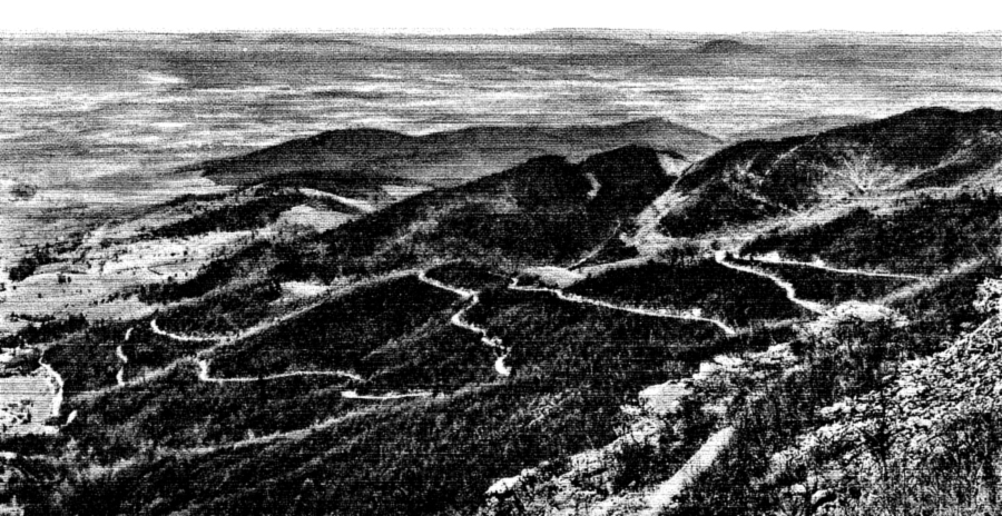
Apr. 1954: Cosby is located in Cocke County, Tennessee. Ramps, real name, “Allium tricoccum,” grow in the mountainous areas of Tennessee, North Carolina and the Virginias at altitudes above 3,000 feet. The self-effacing ramp symbolized the strength and hardiness exemplified by the citizenry of the Tennessee mountains. While one might think that the ramp would dissuade more tourists than it attracted, the first ramp festival drew a crowd of about 30,000 on 25 acres of land. President Harry S. Truman was present as an added attraction. Although the main menu was comprised of corn pone, ramps and sassafras tea, those too wimpy to savor the smelly mountain treat had a choice of barbecued chicken and beef.

Apr. 1955:Mr. Truman returned to his second festival but vowed that he would not eat the pungent wild onions. Summarily, a delegation visited him and gave him a pre-taste of the ramp to acclimate him. The ramp, first cousin to the Lily of the Valley, smells roughly like a cross between an onion and a garlic plant, liberally seasoned with vinegar. While some folks regard it as a delicacy, others eat it in self-defense. Cosby was described as a community that was comprised of nothing more than a country story and a post office run by one of the few Democrats around.

The previous night, a play written by Cosby resident, Delmar Baxter, was presented by local actors dressed in hill country garb and using dialect depicting the Cosby story. The festival was largely the achievement of David R. Large, president of Cosby's Ruritan Club. Truman, after receiving a 21-gun salute, spoke to the crowd. All the while, ramps were cooking in the back.

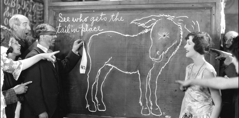
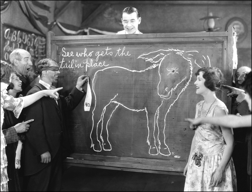
Ramp Devotees Partage of Their Favorite Potent Leeks

Apr. 1956: The 1956 invited guest was Eddy Arnold, internationally known “Tennessee Plowboy” best identified with his song, “Cattle Call.” Also, the University of Tennessee “Pride of the Southland Band” was  secured for the ramp festival that year. Governor Frank Clement delivered the principal address.

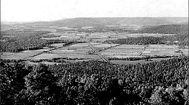
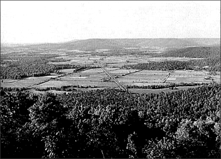
Apr. 1962: The festival was held in Luther Valentine's pasture to honor the mighty ramp, described as being the “vilest-smellin' vegetable grown anywhere on earth.” Interior Secretary Stewart Udall paid tribute to those souls brave enough to eat it, but he did not partake of it himself.” Senator Estes Kefauver bravely consumed a small quantity of ramps.” Cary Fry, a candidate for governor of Tennessee, refused to eat any on the grounds that “no politician wants to smell like that.” Those planning to eat ramps were warned that they would smell like a Billy goat on the second day. 

May 1963:The 1963 gathering saw upwards of 20,000 people gathered at Cosby for a day-long festival of fun in honor of the lowly ramp. The event combined heavy socializing with relaxing in the beautiful area on the fringes of the Great Smoky Mountains along state highways 32 and 73. The entertainers included Dinah Shore, Eddy Arnold, Roy Acuff, Minnie Pearl, Dorothy Collins (“Your Hit Parade”) and regional talent from the tri-state area. Most diners adorned his or her plate with that magnificent maverick, the indescribable gastronomic ramp.

Apr. 1969:The event six years later saw a more modest 6,000 persons gracing Kineauvista Hill that year. The bill of fare was barbecued chicken and beef, sassafras tea, cornbread and of course, ramps, served fried, boiled or raw. They dined while listening to country music from Grand Ole Opry performers, Archie Campbell and Lorene Mann. Also on hand were Sen. Howard Baker and Rep. James Quillen, both Tennessee Republicans.

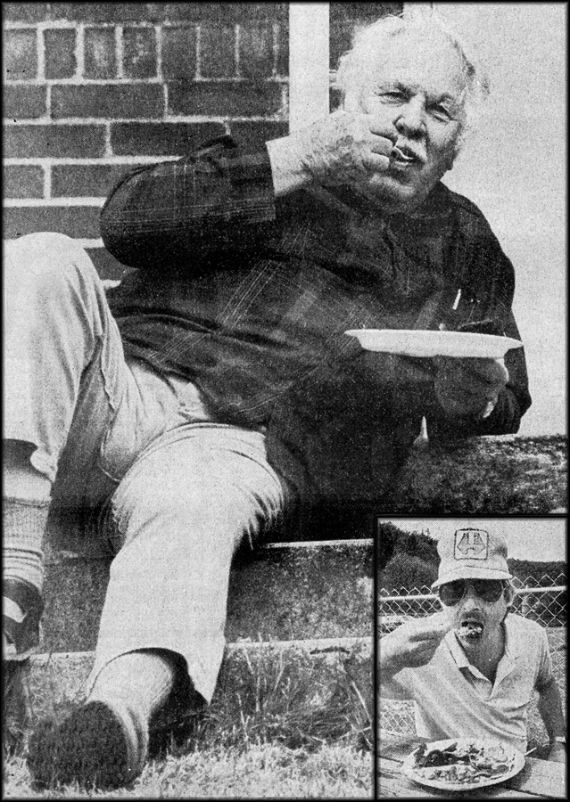
Preparing the Delicacies at a Typical Ramp Festival

July 1971: The first bluegrass festival ever held in the state was held on July 2, 3 and 4 at Kineauvista Hill at Cosby. My wife and I attended that one. The stated location was approximately five miles, south of Newport off Interstate 40. Top notch bluegrass artists signed to appear on the shows were Bill Monroe, father of bluegrass music, who was also a Hall of Fame member; Jim & Jesse; Lester Flatt and the Nashville Grass; The Goins Brothers, Red and Fred; Carl Story, Bobby Smith and the Boys from Sholoh.

James Monroe, Bill's son, hosted the gala, along with Bud McCain of WSM Radio, Nashville, who emceed the show on Saturday afternoon and evening. WSM's Grand Ole Opry announcer, Grant Turner, directed the program on Sunday. An amateur band contest was held Friday, July 2 and any bands wishing to enter was instructed to be at the park to register at 10 a.m. that morning. prizes were awarded.

May 1972:The 19th annual Ramp Festival attracted 8,000 visitors. One guest, not familiar with ramps, looked up the delicacy in a large dictionary. He had to wade through nearly five inches of descriptions for the word, such as “crawl,” “boisterous rage,” “incline,” “swindle,” “bold woman,' “slope” and others. Finally he spotted it: “Any of several plants of the genus Allium.”

May 1975: Several days before the festival began, local club members went into the Great Smoky Mountains to gather 80 bushels of ramps, which was followed by two nights of cleaning and preparing. Then on the big day, fires were started, cooking began for steaming pots of ramps, barbecued chicken, and salads that contained ramps and even scrambled eggs. People came from miles around to eat, visit, play baseball and enjoy a stage program of gospel singing, country music, a beauty pageant and some long-winded political speeches.

Apr. 1981: Advertising for the festival warned newcomers: “Don't be too surprised if there's a run on mouthwash today in this small town. If you plan to eat ramps, you better be sure your wife does also or you will sleep alone for several days. The ad went on to state that ramps are stronger than garlic and ten times stronger than an onion. The “Maid of the Ramps” winner was thrilled with the honor but not the insistence that she eat one of the critters. Her evaluation  of the delicacy was, “I ate one and I didn't go out of my house for a week.” 

May 1988: The 35th festival was held on May 1 with such entertainers as Tennessee Ernie Ford, little Miss Brenda Lee, Archie Campbell, Razzy Bailey, Con Hunley and Del Reeves. The media noted that for generations, people in the mountains had considered the ramp as an important ingredient for their health. That year the menu included scrambled eggs, home cured fried fatback, fried cornbread, and, of course, ramps. Other menu items were a chicken box lunch, hot dogs, hamburgers and a bean plate consisting of pinto beans, fried Tcornbread and fried fatback.

Apr. 2011: Sadly, the Cosby Ramp Festival came to an abrupt finale in 2011 after 57 years of continuous operation. Vandals brutally wrecked the park, leaving the owners without the necessary funds to restore the damage. Its closure was also brought about by a significant drop in attendance in prior years. It was time to give the lowly ramp a well-deserved rest; that year, the annual “smell-a-thon” drifted into yesteryear.

There are other locations around Tennessee that still host ramp days, such as the one at Flag Pond, but the one mentioned in this article went dark in 2011. 

Read more

In May 1933, Tennessee was set to activate the plan of President Roosevelt. Folks along the banks of the Tennessee River were preparing for the “New Deal.” One unidentified southern resident offered this delightful description of the situation:

“The Tennessee River, which runs about 650 miles, is formed by the confluence of the Holston and French Broad rivers near Knoxville, TN and follows a U-shaped course to enter the Ohio River at Paducah, Ky. Navigation has long been impeded by variations in channel depths and by rapids, such as those at Muscle Shoals.

“However, the Tennessee Valley Authority converted the river into a chain of lakes held back by nine major dams. As a result, river traffic increased, flooding was controlled, a water-oriented recreation industry was established and hydroelectric power generated at the dams attracted new industries to the region.

“The languid Tennessee, Belle of the South's river clan and coquettish like a debutante, is ready for its billion dollar coming-out party with President Roosevelt serving as chaperon.

“It is a lazy old river, haughty with its heritage of romance and glamour, and the folks who stir the dirt of its valleys and dig the wealth of its hills are proud that the Tennessee has been chosen by the President for a gigantic experiment of development.

“For unless the best laid plans of men go awry, the Tennessee, “Tenne-seeee” as locals call it, will be the government's lucky charm for the forgotten man, the first trump of the new deal.

A Stereoscope Card Made for 3-D Viewing Shows Photo Taken on Banks of Tennessee River

“The Tennessee is the favorite child of Dixie's river family. The South holds the Mississippi as headman of the bunch and fears the capers of the Arkansas, but the Tennessee, from its source to its mouth, is the pride and joy of river lovers with its 900 miles of power. It is formed at Knoxville by the Holston and Broad rivers along with numerous mountain streams.

“At Knoxville, it bents south. The Great Smoky Mountains, the venerable hills that were old when the gardens of Babylon were new are to the west. Factories dot its banks. Tobacco and grain farms splotch its valleys like green silk in a patchwork quilt.

“The Tennessee gathers speed as it hurries toward Chattanooga, sweeping around great bends and singing a symphony of strength. Its waters turn giant wheels and of its power are born things men need, such as cloth and furniture.

“The mountains fall away as the river hustles down its path, but rises again as it reaches Chattanooga. It makes a hairpin turn at Moccasin Bend and salutes Lookout Mountain, the last mountain sentinel on its southward course and then runs off, being Alabama bound.

“All of a sudden, the country starts to look different. The folks are notably different. Cotton takes the place of wheat and men along the banks follow plows instead of fancy machinery. But the mighty river doesn't change; it waters the land that feeds  the folks. At Guntersville, it changes its mind and, instead of continuing south, sweeps around a bend and heads north again. The climb is tortuous even for the powerful Tennessee.

“It gathered all its strength and makes a spectacular plunge toward Muscle Shoals. There nature cuts a hole in its bed and the Tennessee roars and tosses over the shoals, picking its way through Wilson Dam and then tears away again, free to run its race to the Ohio River.”

Roosevelt's plan came that same year on May 18 in the form of the newly-acted Tennessee Valley Authority. TVA addressed a wide range of environmental, economic, and technological issues, including the delivery of low-cost electricity and the management of natural resources. The Tennessee River would never be the same.

Read more

The Appalachian Trail is a 2,168-mile (2001) footpath for walkers. (According to a 1931 newspaper, it was originally planned for 1200 miles, but has been enlarged over time because of numerous modifications and rerouting.)

The massive, impressive project passes through 14 states: Georgia, North Carolina, Tennessee, Virginia, West Virginia, Maryland, Pennsylvania, New Jersey, New York, Connecticut, Massachusetts, Vermont, New Hampshire and Maine. Perhaps the best definition of the hikers' dream comes from the Appalachian Trial Conference that organized in 1931:

“The trail is a route, continuous from Mount Katahdin in Maine to Springer Mountain in Georgia, for travel on foot through wild, scenic, wooded, pastoral and culturally significant lands of the Appalachian Mountains. It is a means of sojourning among these lands so that visitors may experience them by their own unaided efforts.

“In practice, the trail is usually a simple footpath, purposeful in direction and concept, favoring the heights of land and located for minimum reliance on construction for protecting the resources.”

Booklet Cover from the Appalachian Trail Club

The trail was provided by the lands it traversed and its survival depended on the living stewardship of its volunteers and workers along the Appalachian Trail communities.

The construction of it alongside the Appalachian summits and ridges, began in 1922 in the Bear Mountain and Harriman sections of the Palisades Interstate Park of New York and New Jersey. It was reported to be more than half finished at the fifth annual Appalachian Trail Conference held at Gatlinburg (“The Burg”), Tennessee at the western gateway of the new Smoky Mountain National Park.

The Appalachian Trail project was proposed in 1921 as an extension of regional planning for wilderness recreation through the American Institute of Architects. They seized upon the imagination of members of hearty volunteer support to a degree, which made it one of the most remarkable recreation projects of that time.

Major W.A. Welch, is credited for designing the trail's metal markers with the impressive legend, “Appalachian Trial – Main to Georgia,” which became the emblem of the enterprise.


Appalachian Trail from Franklin Cliffs, Skyland Drive, Virginia

Extension of the Appalachian Trail in various separated portions made necessary a standard marker that could be recognized everywhere. Therefore, Welch changed the legend on the first markers from Palisades Interstate Park Section to “Maine to Georgia,” which was then used all along the way in most of the 14 states through which the trail passed.

Cumulative increase in interest in the following two years led to many new developments and additional groups eager to join in and do their fair share of work. The enthusiasm allowed the trail to be completely marked within the next five years, a remarkable achievement considering the roughness and remoteness of many parts of the terrains over which the trail passed. This was especially true across Northern Maine and in the mountains of North Carolina, Tennessee and Georgia.

Besides interest shown by outdoor clubs, the effort was supported by many public agencies and officials, including the Nation Forest Service, state parks and forest commissions, Boy Scout Councils and others. Interest was spreading like wildfire.

The significance of the great trail was envisioned as a spinal cord for wilderness recreation paths in the eastern mountain areas. It stimulated the enthusiasm of all who enlisted in the work with each passing year.

Appalachian Trail Brass Challenge Coin

The 1931 meeting was held in the South in recognition of the impressive development in the project that had occurred there during the previous year and to stipulate it further. It was under the auspices of the Smoky Mountain Hiking Club of Knoxville, Tennessee, of which Prof. H.M. Jennison of the department of Botany, University of Tennessee, was president.

The construction of the Appalachian Trail in the Great Smoky Mountains area was expected to be furthered by the impending development of the new and exciting National Park therein. Timing could not have been more convenient for both momentous ventures.

The Smoky Mountains Hiking Club marked the route into more accessible sections. Crossing Indian Gap, the park forces were helpful in making and maintaining it into the more rugged and remote portions in the northern part of the area still being acquired for eventual addition to the Park.

The supervisors of the Unaka National Forest, extending from the Virginia border into North Carolina and the Cherokee Forest in Western North Carolina and Southern Tennessee, were helpful by designating and marking miles of the Appalachian Trail. The newly formed Carolina Appalachian Trail Club of Asheville, North Carolina was likewise active in the Smoky Mountains.

In Virginia, a new and energetic group, the Potomac Appalachian Trail Club accomplished an immense amount of work along with the Virginia Blue Ridge from Harper's Ferry to the Shenandoah National Park area and beyond.

Appalachian Trail Patch

In Georgia, the state Forestry Department had been co-operative and one of its assistant foresters had formed the Georgia Appalachian Trail Club, which had marked the trail from its southern terminus at Mount Oglethorpe, northward to the Tennessee line.

Important developments from New England were also reported at the Gatlinburg meeting. A promising amount of literature began to develop as informative guides to the Appalachian Trail became available to the public. The Potomac Appalachian Trail Club also published a map to the Virginia section.

Thanks to the efforts of all the individuals and organizations in this article, the Appalachian Trial, a hikers' wildest dream, became a reality and is still with us today.

Read more