Weather

In January, 2010, I wrote an article about the collapse of White Rock Summit on Buffalo Mountain that occurred Jan. 25, 1882. A few newspapers from around the country and one from Mexico began to slowly report the news.

An Old Newspaper Reports the Collapse of White Rock on Buffalo Mountain

Roughly 750 Johnson City residents experienced something that afternoon that left them helpless and reeling with fright. A powerful crash and terrifying rumbling noise that could be heard 30 miles away came from the mountain, caused by a major rockslide that occurred on the southeast terminus of the mountain.

Panic-stricken inhabitants living in close proximity to the mountain fled from their dwellings seeking protection, fearing that an earthquake was besieging the East Tennessee countryside. A number of folks gathered together to pray for deliverance from the falling mountaintop.

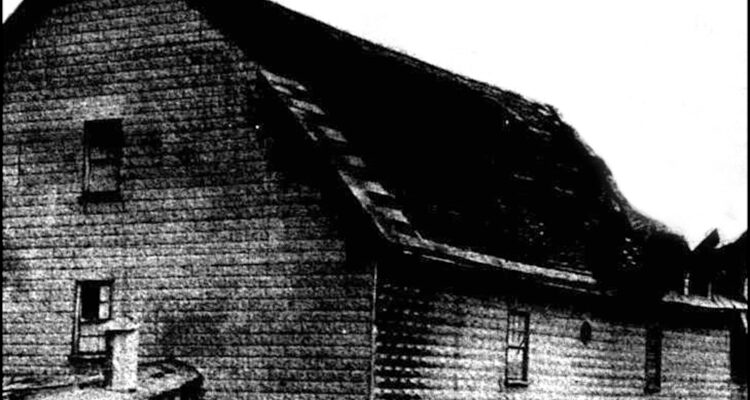
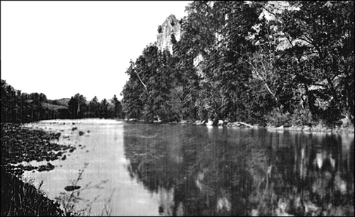
White Rock on Buffalo Mountain As It Appears Today

Recently, I located another and more detailed source dealing with the 1882 collapse. The crash occurred at 3 p.m. on that Wednesday. When news reached the Knoxville Chronicle that a section of Buffalo Mountain, located in upper East Tennessee, had crumbled to the valley, a reporter was immediately dispatched to Johnson City, the closest town to the scene of the devastation. Upon arriving, he learned that White Rock Peak (referred to as White Rock Summit in other publications) had succumbed to geological agencies, namely continuous rains, spreading debris over a large mountainous track of country.

Procuring a guide and two good horses, the riders apprehensively began their trek up the mountain. Snow was falling in the valley and as they made their ascent to the peak, the drifts became deeper and deeper. By the time they reached the summit, using a circuitous route, the accumulation was 18 inches.

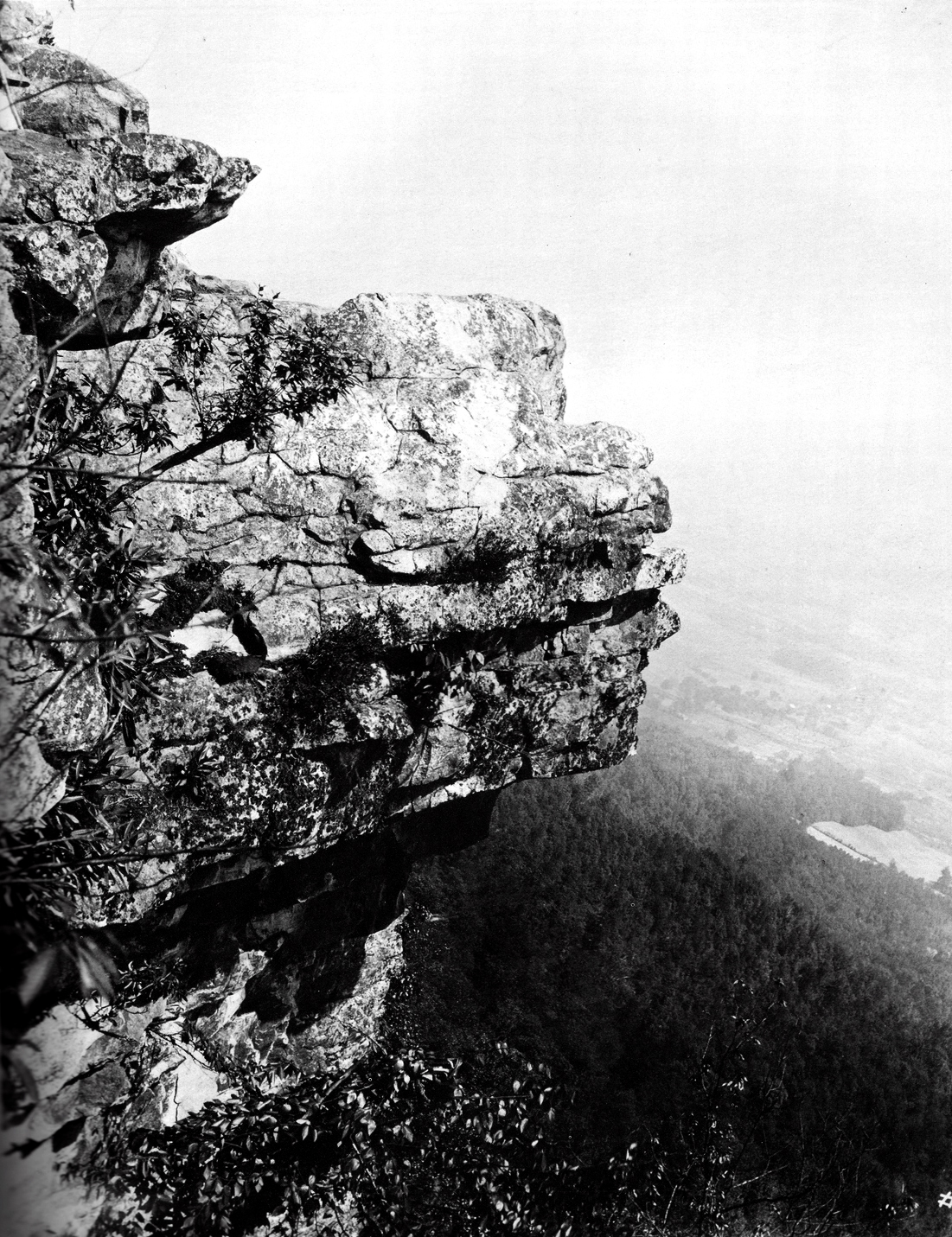
Prior to the huge structure of quartz crystals falling prey to natural forces, the mass could be seen from afar, appearing as a specter standing guard over the towns and valleys beneath it. The rock was nicknamed “Lone Sentinel” by some residents. It was, by far, the highest peak on Buffalo Mountain.

Amazingly, the end of the mountain which formed the massive rock was about 1500 feet above the surrounding countryside and was almost a perpendicular cliff'. The rest of the mountain, excluding the rock, was covered with a heavy growth of timber, prominent among which was oak and chestnut trees. The brow of the mountain was estimated to be a half mile or more across and composed for the most part of white sandstone.

When the newspaper team arrived at the top of the mountain, they gazed in wonder and astonishment. There in front of them, now partially covered with snow, they witnessed debris strewn for a mile down the mountain side, the result of the stupendous crash.

Rocks as big as houses had been hurled into the valley with a terrible force, uprooting trees and cutting down everything in its path.

The track of the rocks in their terrible downward departure was perceptible for a mile or more. A boulder weighing several tons, which had somehow diverged from its course, was lodged against a single tree, but most of the rocks of all sizes had fallen to occupy the valley below.

Trees several feet in diameter were cut completely in half, some as high up as 40 feet, clearly showing what a powerful force must have urged the rocks to ascend to a lower position. They could but stand in mute admiration of the slow yet steady and powerful forces of nature which had moved the end of the mountain to the mountain ridges to the west.

After the rumble ceased, solid rock composed of white sandstone glittered in the now bright noonday sun, the radiance of whose rays could be seen for miles by onlookers. Because of its white appearance, the rock had acquired its name, which reportedly was on record several places in written history.

The two men conversed with several area persons in regard to the cause of the great fall of rock. Some were of the opinion that the crash was caused by a movement in the earth's crust, like an earthquake. Others were of the convinced that it was the result of what geologists term “aqueous agencies.”

Those residents who wanted to know what happened were vividly aware that since Christmas 1881, the area had undergone a continuous deluge of rain. Water managed to infiltrate the rock in the frigid climate and then freeze, causing it to expand and split the rock, ultimately to a depth of a hundred feet or more. It was generally speculated that this destructive force had been at work causing the big rock to fall into the valley below.

My new source offered an interesting historical note to the property beneath the rock. It was frequently spoken of in history books of Tennessee as the spot where Governor John Sevier and his friends and Colonel John B. Tipton and his allies met in a bloody and fatal scuffle just 94 years prior (1788).

While this portion of the state was still a part of North Carolina, it seceded and set up a state government of its own in 1784, calling itself “Franklin.” Governor Sevier, was elected chief magistrate and commander of the militia. North Carolina, still claiming this territory, appointed her officials, thereby causing a conflict.

Colonel John B. Tipton was chosen County Court Clerk of Washington County. He lived at the foot of White Rock and Governor Sevier, followed by 150 men, proceeded to the house of Tipton to divest him of the official papers. Colonel Tipton, backed by a strong force, routed the Sevier allies. Several men were killed and wounded during the day on account of this engagement.

Although White Rock has often been referred to in the histories of Tennessee with pride, now that it passed through such a transcending ordeal, its name will shine even brighter in the archives of yesteryear.

Read more

On Tuesday, March 1, 1955, turbulent winds from a funnel-shaped cloud ripped off roofs demolished barns and turned boats upside down in the Boone Lake area.

According to the Weather Bureau at Tri-Cities Airport, although winds ranged as high as 80 miles per hour, no injuries were reported in the brief, yet violent storm. Reports from the Flourville area described the squall as rushing along with a sound like a truck. Almost immediately, the area became ominously dark.

Flourville Mill Roof Damage Can Be Seen

The roof of the Flourville Mill (makers of Daniel Boone Flour and Becky Boone Corn Mill) was heavily damaged off, with damage unofficially estimated at around $1200. Hal Wexler’s barn was demolished and sections of it were hurled in a westerly direction into Boones Creek. Large trees were uprooted in the vicinity and several of the side roads were totally blocked by debris.

A boat house belonging to Bert Couch and Ivan Good was tossed on its top, the strength of the wind breaking a one-inch steel cable that was holding it. Dr. Nat Winston’s boat was reported to have been lifted up and blown to dry land while other crafts were flipped on their side by the strong wind gusts.

V.C. Ford, owner of the Boones Creek Boat Dock, said that he was sitting in his car when the storm struck, resulting in the back end of his vehicle being blown around about three feet. “I was scared to death,” he said. He added that one boat was blown about 300 yards.

Portions of Roy Brummit’s barn were carried about half a mile and sections of the tin roof were scattered over adjoining fields, with some of it landing in trees. A truck owned by Jim Crouch was also swerved around in the road for about three feet. Several residential window panes were reported broken and damage inflicted to roofs.

The storm, which many residents described as a ”baby twister” hit the Flourville area the hardest, although other sections received high winds and rain.

Nearby Johnson City received a heavy rainfall accompanied by winds about the same time as the storms struck the Boone Lake area. Also, Kingsport streets reportedly were flooded by the deluge. A barn near the Tri-Cities Airport and a radio range tower of the Weather Bureau were knocked down.

The weatherman said the storm moved eastward at about 40-50 miles per hour. For those residents in the storm area, which extended over a radius about two miles, the groundhog must have had seen his shadow a month earlier because the weather roared in like a lion that day.

A Spokesman for the Johnson City Power Board noted that considerable damage resulted from the wind, which entangled power lines causing short circuits. He said that the trouble was sporadic over a fairly large area and not confined to any one section of town. All crews worked to restore serves to the relatively small percentage of power users who were affected.

The Inter-Mountain Telephone Co. reported the problem of “wet cables” following the heavy rain and that emergency crews were hard at work to repair the damage. Company officials said that a total failure on the line had been occurred between Knoxville and Atlanta.

Cloudy skies were occurred for the remainder of the day, with scattered showers and thunderstorms in the afternoon. A springtime temperature was forecasted by the weather man for the day with a high around 70.

In Morristown, a large tree fell across some Southern Bell Telephone Co. lines, knocking out telephone services to all Tennessee points east of the city. The company also reported that 70 of its long distance circuits were cut by trees, felled by wind gusts up to 82 miles per hour. The outage occurred about 7:30 a.m. near Whitesburg, about 15 miles east of town.

Associated Press news service to newspapers and radio stations in the upstate area was affected temporarily by the weather.

At Knoxville Municipal Airport, a strong gust of wind picked up a Piedmont Airlines two-engine plane and slammed it into a fence.

How many of my readers recall that troublesome 1955 spring day?

Read more

On August 14, 1940, a devastating flood occurred in Elizabethton, brought about by a massive overflow of the mountain-fed Watauga River. The 24-hour torrential rain was the remnant of a 91-mph hurricane that, after pounding the South Carolina and Georgia coasts, took direct aim at East Tennessee. The Watauga, normally a peaceful mountain stream about 50 feet wide and only a few feet deep, rose to a staggering 26 to 30 feet and a quarter of a mile wide.

Workers, scampering about in total darkness, rescued persons desperately clinging to trees and housetops after the rising waters swept the Rio Vista region that was adjacent to the city, home to about 150 residents. Authorities began preparations for an orderly evacuation of as many residents as possible.

Mrs. Bob Shell, 54-year-old mother of seven children, became a victim after being trapped in an automobile with her husband and 83-year-old mother when they fled their engulfed home that was located beside the river. The flood also caused heavy property damage.

Sergeant Claude Buckles of the Tennessee Highway Patrol believed that a number of persons drowned as the stream caused the water to rise 20 feet between nightfall and midnight. Although the waters began to rapidly recede, it was daylight before an accurate death toll could be determined.

Don Calfee, managing editor of the Johnson City Chronicle, said he witnessed the bodies of two men being pulled from the water. The small community was adjacent to two large rayon plants, Bemberg and North American Rayon, which had become the hub of industry for this city of approximately 10,000 people.  W.S. Argabright, the telephone company manager, said a number of persons were marooned on house roofs as darkness handicapped rescue work.

To assist rescue efforts, a truckload of boats and additionallaw enforcement officers were rushed from nearby Johnson City. Deputy Sheriff Campbell said that every available man who could be located was deputized for relief duty and began patrolling the washed out section. 

Nearly half of the East Tennessee and western North Carolina mountain streams bulged from their banks after the downpours. Floods in western North Carolina wrought undetermined property damage to industries and dwellings, interrupted rail and motor traffic.

Asheville’s City Manager said that his city's 51,000 residents faced a major crisis unless repairs were made within 36 hours to three large water mains feeding the two city reservoirs. Workmen, reaching the intakes in the mountains 20 miles away, reported several hundred feet of one 24-inch main washed out and sections of two 18-inch ones broken.

The Swannanoa and French Broad rivers, converging at Asheville, swept out of their banks, forcing hundreds of residents from their homes. Heavy rains sent streams rising rapidly in the Piedmont section of South Carolina from Augusta, Georgia to the North Carolina line. Many highways were closed to traffic.

A young man from Denver, Colorado drowned when his boat plunged over a dam at Lake Eden into the Swannanoa River. Thousands of summer tourists were marooned at dozens of resorts when landslides halted east, west and northbound traffic over the Southern Railway. High water washed away bridges and covered highways in numerous areas.

After the water began receding here, flood warnings were issued for Kingsport on the Holston River 40 miles from Elizabethton and some 1,200 persons living on Long Island near the Tennessee Eastman plant were hastily evacuated.

After the disaster ended, North Carolina counted six deaths from drowning and landslides. Three more were reported near Galax, Virginia and Elizabethton had three. One fatality occurred when a woman died of a heart attack after learning that floodwaters were approaching her home.

Read more

The Tennessee Valley Authority, a federally owned corporation, was formed in 1933 with a five-fold purpose: flood control, power generation, economic development, river navigation and fertilizer manufacturing.

Timing was ideal due to massive flood problems over the years and a country trying to survive the Great Depression. TVA served most of Tennessee; parts of Alabama, Mississippi, Kentucky; and small slices of Georgia, North Carolina, South Carolina, West Virginia, Indiana and Virginia.

Before TVA existed, the East Tennessee area experienced a long history of devastating floods. In one incident that occurred in late May 1901, millions of dollars of damage and eight lives were lost from heavy rains that caused area rivers to overflow their banks. The Doe, Watauga, Holston, Chuckey and French Broad rivers devastated growing crops and anything in its way. Six bridges were swept away causing $60,000 damage.

Over the course of several weeks, the Holston River steadily rose. Persons living near the river at the point where Netherland Island divided it in Washington County told of a remarkable discover by area resident, James Light. When the water began to manifest itself, people congregated on the banks, watching houses, barns, parts of bridges and dead cattle floating away, laying waste to fertile farmland.

The spectators along the bank spotted an object coming down the river that resembled a baby cradle. Mr. Light, a humble but daring citizen of the community, sat in his boat anchored on the bank and watched the object drift nearer. At the risk of his life and the hope that he might rescue what appeared to be an innocent baby from the ferocity of the flood, he shoved his boat forward into the dangerous current and hurried toward the object. After dexterously guiding his boat so as to escape being wrecked in the drifts, he finally rendezvoused with the infant at an angle a short distance down the river.

His boat soon came alongside the floating object, which proved to be a cradle in which lay a tiny blue-eyed baby girl, her eyes wide open and apparently happy as if on a pleasure outing. James picked up the child without disturbing her and carefully placed her in his boat. Once again, he surveyed the swirling drifts floating down on each side of him and steered frantically toward the shore. Every second counted.

The return voyage was a short one but full of peril. People on the bank, unaware that Light had picked up a little girl from the bosom of the storm-swept river, watched with great fear and trembling as he made for the shoreline. Intense was the gaze of those who watched from the shore and great was the relief to everyone when Light finally made a safe landing nearly half a mile downstream.

Joy was unbounded by the crowd of people who had gathered around Light and the baby. In a moment of emotion he called his little rescued treasure a “bundle of joy.” The ladies surrounding the near tragedy fondly and eagerly caressed the infant while Light received hearty congratulations and appreciation for being a hero, making him the proudest man in Washington County. He quickly forgot his personal losses caused by the tide.

In today’s era, local authorities would be summoned to handle the situation and to locate her parents, but in 1901, that was not the case. Since there was no available means of promptly identifying the child, Mr. Light announced to the crowd that he wanted them to spread the word. Also, he said he planned to advertise in the local newspapers in hopes of locating her parents. He admitted that, as poor as he was, he would not part with the child for a thousand dollars in gold.

The stories of yesteryear abound with this one having a happy ending. 

Read more

Brush Creek is a stream of water that is very familiar to Johnson Citians, largely because of its long history of flooding. The name is reported to have originated with Abraham Jobe who owned land along the creek in what became the business section of the town. He once related that a heavy mass of red brush grew along the creek and obstructed the view except for those riding on horseback. Apparently, the name stuck.

A 1959 TVA publication concerning floods on Brush Creek in the vicinity of Johnson City stated that in 1908 there were 29 road and 14 railroad bridges that crossed the winding creek within an 8.75-mile span. The resulting 43 overpasses and nearby buildings with columns became hindrances to adequate water drainage from the area.

The 44-page report further noted that the greatest flood recorded since 1868 occurred on May 29, 1908. The second highest one happened on August 9, 1938. One million square feet of land in the downtown section was adversely affected by 3,300 feet of creek.  Although there were no definite records of floods on Brush Creek prior to 1901, it is known that several major floods occurred in the business district. One of the best sources of knowledge on this subject comes from a diary kept by a local resident, Robert P. Fickle. His notes, while unofficial, shed added light on the city’s flood problems of yesteryear.

Mr. Fickle referred to “a great tide sometime in 1790.” He also mentioned 1817, 1835, 1847, 1848 and 1851 as years in which significant deluges occurred on streams in the upper East Tennessee region. On Sept. 15, 1861, he wrote, “A tide was made by a hard rain, which continued for four or five days with intermissions of 6, 12 and 24 hours. This tide was somewhat higher than the one seen in 1817.”

On Feb. 21, 1862, he noted, “It commenced raining steadily and rained without any intermission on the 21stand on during the night following until daylight on the 22nd.  This tide was about two feet higher than the tide of 1861. This was a general tide (that extended) throughout the Southern Confederacy. Rain was general throughout the southern states.”

In March 1867, Mr. Fickle recorded that “The greatest tide yet in Holston River history was caused by the most unprecedented raining season known only to the oldest people. This was the great storm that caused flooding all over the eastern part of the Tennessee Valley and resulted in the highest floods ever known at Knoxville and Chattanooga. Great damage was done on the rivers and creeks. Bottoms on the river were damaged either by being washed into holes and gutters or covered by sand. Many mills were carried off, also houses, barns and stables thought to be out of reach of high water.”

In February 1875, the Fickle diary pointed out heavy rains that fell for several days that resulted in “raising the branches more than at any time since the great tide in 1867. Great damage was done to property along the water courses and a vast number of rails were carried off.”

While none of the flood comments specifically mentioned Brush Creek, there is no doubt that on most of these occasions rainfall over the Brush Creek watershed would have been sufficient to produce large floods along the creek. It is quite possible that the great storm of 1867 produced a flood in Brush Creek of greater volume and height than any that have occurred since.

Thanks to Mr. Fickle, we garner additional facts about the troublesome little creek that still occasionally wakes up from its restless slumber and climbs precariously out of its turbulent bed to the chagrin of nearby property owners. 

Read more

In a previous column, I described Spurgeon’s Island near Gray, TN as having been a popular “lovers’ lane” of yesteryear. Kathy Reed sent me a September 25, 1936 Johnson City Beacon newspaper clipping bearing the title, “Gray Station Folk Hearing Again of Miracle of 1901.” 

The account referenced a yellowed-with-age June 13, 1901 Johnson City Staff newspaper article, saved by Mrs. George Bowser, concerning a May 21 destructive flood around Spurgeon’s Island. On that momentous day, nine people were on the island, including Professor T.C. Garst, who was setting his fishing lines just below the confluence of the Watauga and Holston Rivers.

Those present noticed that the waters of the Holston River were rising quickly but saw little cause for alarm. However, the gravity of the situation soon became apparent when the men became fully encircled on the 25-acre island. One individual, Clinton Woods, had his boat with him. He hastily put his group – Charles Martin, David Denney, Abraham Hale and Alex Berry – into his craft and slowly and treacherously steered it to the mainland.

The four remaining individuals – Garst; Robert Berry and his ten-year-old son, Fuller; and William Hale – made camp, built a fire, ate supper and anxiously waited for the floodwaters to recede. By nightfall, the rising river forced the fishermen to relocate their campsite to higher ground. Before long, they were forced to take sanctuary in nearby trees; the nightmare was about to begin.

The Beacon vividly described the enormity and horror of their precarious tree clinging experience: “The waters continued to rise higher and higher, forcing them to drop into the flood and swim for other trees, which they heard and saw dimly as the raging howling flood swept most of the trees up by the roots and carried them away. They heard the horses neigh – then drift away to their death in the swirling stream. The hack, tied first to a tree, was also washed away. There were deafening crashes; trees sped by; debris, driftwood, logs, even houses, came down with the flood, and crashed against the cliffs opposite them. It was toward morning when a jamb of logs and drift above them broke. It was wedged across the river. With a thundering blast, it broke, but providence intervened, and sent it to the right and left, barely missing the tree where the four men clung.”

Twelve more hours transpired before the river began to recede. A woman standing in the doorway of her mud-splattered home suddenly spotted the exhausted sportsmen. Soon, a crowd of spectators and rescue personnel arrived on the scene; the weary quartet was quickly transported to their homes.

The newspaper continued: “Professor Garst devoutly considers their rescue a miracle. He refers to the prayers they sent up from their perilous perch during the moments when it seemed all was lost. The old legend is still there. There are some other trees growing there, some few that were left from the torrents of that night, in whose branches someway, something – undoubtedly a Divine Providence – found safety through that night of terror – and live to tell the tale.” 

Thanks to Kathy Reed, a miracle that occurred over a century ago at remote Spurgeon’s Island can now be retold to a new generation of area history lovers.  

Read more