Throughout the years, most small towns that develop into large cities acquired small nicknamed districts that typically vanish with time as the city grows. Johnson City was no exception.
Today’s column deals with some of these localities, most of which are no longer called by that name. See how many of the dozen appellations below you can identify with or perhaps have heard about.
Potlicker (also spelled potlikker and pot liquor) Flats was the vivid label bestowed on a section on the west end of town that surrounded Fall Street. The name likely was derived from a term meaning the broth left in a pan after cooking vegetable greens (collard, turnip or mustard), beef or pork.
Another section of town, loosely sited around Walnut Street at Roan, was called Dogtown. We can only surmise that the area had an inordinate number of dogs roaming around it. Can anyone provide additional information?
Carter Addition denotes another section that endured for some years. It was a tract of land beginning at Virginia Street and running out to the university, taking in sections of Pine, Maple and Walnut streets. It was named for George L. Carter who also lived there and sold land around it.
Stumptown was located east of Roan near Grover Street. It was dubbed by that name because long ago when there were only three houses built there, the surrounding area was cleared of trees but work was stopped, leaving the stumps still standing. This was a benefit for nearby residents because “stripping” the stumps provided a quick and convenient source of firewood.
Tannery Knob, the hill on the north end of Legion Street, was so-called from the tannery business located at the foot of it that was once operated by Henry Gildersleeve.
Although Maupin Row off King Springs Road still denotes a street, the old Maupin Row section extended out Locust Street to Southwest Avenue and on toward the university. It got its name as an honor to a revered Salvation Army preacher, Theodore Arrowood, and his wife, Reecie, known as the “Angel of Maupin Row.”

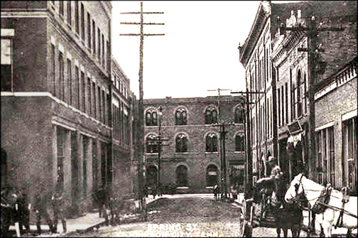
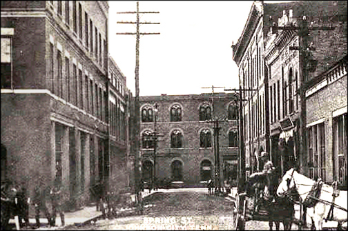
The well-known Spring Street cut through a section of downtown that began at E. Main and extended south across the railroad tracks. It acquired its name from a spring that was located at the head of it. Further down the street was a croquet ground where Johnson Citians could engage in the then popular outdoor sport using wooden balls, wire hoops and a mallet. Thomas E. Matson, who was a civil engineer with the ET&WNC, put in a line that carried water from the spring to a business on Tipton Street. He also constructed a standpipe on that line which permitted water to flow into a trough near the location of Poplar Street that provided refreshment for cows and horses.
Perhaps the smallest parcel of land to acquire a name was Fonde Circle (mentioned in my recent Stella Lent article). It was a triangle of ground on the Southern Railroad property where the tracks now cross Market Street. For years it was an unsightly trash heap. When Mr. Fonde, a regional superintendent for the railroad, died, the railroad created a job for his widow to beautify locations along the adjacent train tracks. In that parcel of land, she planted shrubbery, grew flowers and even installed a small pool as a living memorial to her late husband.
Four additional sections of town were Jenny’s Hill situated behind Robin’s Roost on South Roan Street where the first reservoir in Johnson City was sited; Squirrel Hill around Piney Grove; Clinch Hollow, an area on Cherokee Street above Southwest Avenue; and Master Knob a quiet secluded hill on the east side of the intersection of Oakland Avenue and Princeton Road (my favorite place to explore).
Over time, many of the nicknamed districts slipped quietly into yesteryear, but a few are still withy us. If you have others to share, please send them to me.

Comments are closed.