Recently, I read an interesting entry from Jeff Fleming's impressive (www.kingsportblogger.com) website, written in 2008 about a Powell County being located in East Tennessee in 1839. An inspection of a current map offers no hint of the county.
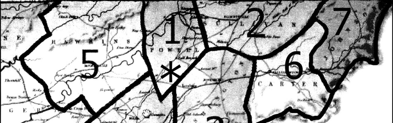
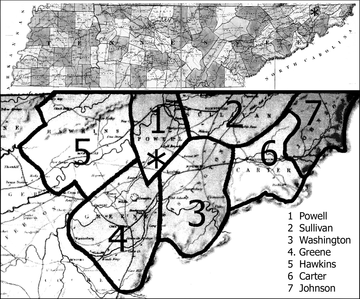
Fleming acknowledged that Kingsport's GIS staff located an 1839 Tennessee map showing Powell County, at the Tennessee-Virginia border sandwiched between Hawkins, Greene, Washington and Sullivan counties. Jeff provided added information from the 1840 Acts of Tennessee.
The county seat was Fall Branch and included the cites of Kingsport, New Canton, Church Hill, Mount Carmel, Carters Valley, Lynn Garden, Bloomingdale, Colonial Heights, Fall Creek, Sullivan Gardens, Haws Crossroads, Baileyton and Graysburg Hills.
I decided to pen a column on this subject. Cartography Associates (www.davidrumsey.com/maps3220.html) owners of the map gave me permission to use it in my column.
My further research uncovered a book titled, Acts Passed at the First Session of the Twenty-Third General Assembly of the State of Tennessee, 1939-40 (Published by Authority, Nashville, J. Geo. Harris, Printer to the State, 1840). The book can be viewed on-line as a free ebook.
The Act specified that a new county be established of fractions taken from the four above named counties and that it be identified as Powell County in honor of Samuel Powell, one of the judges of the circuit courts of Tennessee.
A lengthy antiquated description of the new county's property lines taken from the other four was given, beginning with the words: “The county of Powell shall be bounded as follows, viz; Beginning on the north bank of Holston River, ten miles from Blountville, running thence south sixteen degrees east three miles to a stake, south thirty-three degrees three miles and fifty poles to a stake in Chase's field, south sixty degrees west … (and on and on).
Individuals from each of the four counties that were contributing land to new Powell County were named: Washington County (Terry White, Joseph B. Gilman), Sullivan County (James P. Hulse, Joshua Shipley John Peoples), Hawkins County (Joseph Smith, John Ball, Jr.), and Greene County (Elijah Hendrick, Andrew English, and James Shanks). The commissioners were approved by each state's county court after which a bond and security payment was made in the amount of $5000.
Newly appointed commissioners of the four counties were required to hold an election to decide if that county was in favor of forming the new county. Each voter was instructed to mark his ballot with “New Country” if he agreed with the change or “Old Country” if he was opposed to it. The election was to be decided on a simple majority rule basis. If Powell County was approved, it would receive all the powers, privileges and advantages along with the liabilities and duties affiliated with being a new county.
Those counties who failed to vote in the election, for whatever reasons, were required to hold one as soon as possible; irregularities were to dealt with promptly.
Powell County's court was to be temporarily held at the storehouse at Gammon & Company on the Fall Branch side of Horse Creek until a permanent seat could be established. Also, all officers, civil and military, were instructed to hold their offices and exercise all the powers and functions thereof until other locations were available.
Powell County was authorized to form one military unit to be known as the 148th Regiment and attached to the third brigade. The final section of the Act warned that if property line disputes arose, they were to be swiftly referred to a surveyor to resolve the questionable areas.
The Powell County Act was presented by Jonas E. Thomas, Speaker of the House of Representatives and L.H. Coe, Speaker of the Senate on Nov. 30, 1839.
This material did not reveal why the state wanted a new county or what happened to it. I will shed further light on this subject in an upcoming column.
Comments are closed.